The Tools menu provides a collection of utilities for file conversion, data processing, and creating animations. These tools are designed to help you prepare your data for use in EVS.
Accessing Tools
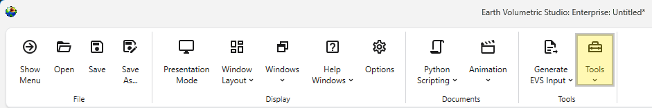
The Tools button can be found in the Main Toolbar. Clicking it will open a list of available tools.
Tool Buttons
EVS Input File Conversions
This section contains tools for processing and converting various data files into formats optimized for EVS.
| Tool | Description |
|---|---|
| Data Reduction | This utility helps you manage large datasets by reducing the number of data points. It can be used to sample or filter your data, which can improve application performance and reduce processing times with configurable loss of detail. It is used to get optimal results when kriging dense data. See the Dense Data tutorial video. |
| File Refinement and Filtering | Use this tool to clean and refine your data files. It allows you to apply filters to remove outliers, correct errors, or extract a specific subset of your data based on defined criteria, ensuring higher quality input for your models. |
| Convert LSDV to LPDV | This is a file conversion utility to transform boring based Lithology Screen Data Value (.lsdv) files into the point based Lithology Point Data Value (.lpdv) format. |
| Convert GEO to GMF | This tool converts the Borehole Geology (.geo) file format into the Geology Multi-File (.gmf) format. This is useful if you want to replace a single surface in a GEO hierarchy (such as the ground surface) with more high-resolution data that is not synchronous with your .GEO borings. |
Image and Animation Tools
This group of tools helps you create animations and prepare images for use in your projects.
| Tool | Description |
|---|---|
| Images to Animation | This utility takes a sequence of individual image files and compiles them into a single animation video. This is useful for creating time-lapse visualizations of your models or other dynamic presentations. |
| Georeference Image | Creates and edits world files or .gcp (ground control point) files for images. Use this tool to assign real-world geographic coordinates to a raster image, such as an aerial photograph or a scanned map. Georeferencing allows the image to be accurately positioned and scaled within your 3D scene alongside other spatial data. |
Legacy File Processing
This section provides tools for working with older, outdated file formats.
| Tool | Description |
|---|---|
| Legacy Field Converter | Reads older format files that can contain EVS Fields, such as Field (.FLD), UCD (.INP) and netCDF files (.CDF) and converts them to standard EVS Field File format (.EFB). The .EFB format is used because it is the smallest and old file formats do not require the more complex features that the .EF2 format allows. |
The Images To Animation tool allows you to compile a sequence of individual image files into a single video animation. This is ideal for creating time-lapse visualizations, showcasing model changes over time, or presenting a series of related images, for example written by EVS through sequences and Python Scripting, as a dynamic video.
The Georeference Image tool is a useful utility for assigning real-world geographic coordinates to raster images. This process, known as georeferencing, allows you to accurately overlay images with other spatial data in your project. The tool enables you to create and edit world files (e.g., .jgw, .tfw) or ground control point files (.gcp), which store the image’s location, scale, and orientation information.