LPDV Lithology Point Data Value File Format
The LPDV lithology file format is the most general, free-form format to represent lithology information.
To understand the rationale for its existence, you must understand that when creating lithologic models (smooth or block) with lithologic modeling, the internal kriging operations require lithologic data in point format. Therefore all other lithology file formats (.PGF and .LSDV) are converted to points based on the PGF Refine Distance. LPDV files are not refined since we use the point data directly.
LPDV files have the following advantages and disadvantages:
- Advantages
- Is not based on borings or screens
- It can represent surficial lithology data (material definitions at ground without depth)
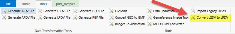
- LSDV formats can be converted to LPDV and merged with other LPDV data. This is done with this Tool
- Disadvantages
- Files tend to be larger since a single screen can represent many points
- Displaying boring based data is more limited
- LPDV files cannot be further refined.
- If your points are too coarse or too fine, you cannot easily change this.
An explanation of the file format follows:
-
You may insert comment lines in .lpdv files.
-
Comment lines must begin with a ’#’ as the first character of a line.
-
- Entries on lines can be separated by commas, spaces and/or tabs.
- The First (uncommented) line:
- Must begin with Elevation or Depth
- For the data section shown below, when Depth is specified, replace Z with Depth and columns 5 & 6 are required
- Then each material specified in the file is listed as: "Materialnumber|Materialname"
- The end of the line has the coordinate units (typically m [meters] or ft [feet]), OR the REPROJECT tag.
- Must begin with Elevation or Depth
- The next line begins the data section. You do not need to specify the number of data lines. The 9 entries in each line are all required and therefore must be:
- Columns 1-3: X, Y, Z
- Column 4: Material-number (these are integers which should begin with zero on line 1)
- Column 5: Boring ID : OPTIONAL, however, if any line has this then all lines must have it.
- Column 6: Ground Surface Elevation: OPTIONAL, however, it can only be included if Boring_ID is included and if any line has this then all lines must have it.
Below is a snippet of the file "lithology.lpdv" in the "Exporting Data to C Tech File Formats" folder of Studio Projects. This file was converted from lithology.lsdv.
Elevation "0|SAND" "1|SANDSTONE" "2|GRAVEL" "3|MUDSTONE" "4|LIMESTONE" "5|SILTSTONE" "6|MADEGROUND" "7|CONGLOMERATE" "8|GYPSUM" "9|CLAY" "10|SILT" m
736133.267249 1637594.558440 1190.194000 0 720B0001 1190.200000
736133.267249 1637594.558440 1189.806000 0 720B0001 1190.200000
736133.267249 1637594.558440 1189.794000 1 720B0001 1190.200000
736133.267249 1637594.558440 1189.006000 1 720B0001 1190.200000
736133.267249 1637594.558440 1188.206000 1 720B0001 1190.200000
736133.267249 1637594.558440 1188.194000 0 720B0001 1190.200000
736133.267249 1637594.558440 1187.806000 0 720B0001 1190.200000
736133.267249 1637594.558440 1187.794000 1 720B0001 1190.200000
736133.267249 1637594.558440 1187.256000 1 720B0001 1190.200000
736133.267249 1637594.558440 1186.706000 1 720B0001 1190.200000
736133.267249 1637594.558440 1186.694000 0 720B0001 1190.200000
736133.267249 1637594.558440 1186.156000 0 720B0001 1190.200000
736133.267249 1637594.558440 1185.606000 0 720B0001 1190.200000
736133.267249 1637594.558440 1185.594000 2 720B0001 1190.200000
736133.267249 1637594.558440 1184.906000 2 720B0001 1190.200000
736133.267249 1637594.558440 1184.206000 2 720B0001 1190.200000
736133.267249 1637594.558440 1184.194000 1 720B0001 1190.200000
736133.267249 1637594.558440 1183.453000 1 720B0001 1190.200000
736133.267249 1637594.558440 1182.706000 1 720B0001 1190.200000
736133.267249 1637594.558440 1181.959000 1 720B0001 1190.200000
736133.267249 1637594.558440 1181.206000 1 720B0001 1190.200000
736133.267249 1637594.558440 1181.194000 1 720B0001 1190.200000